On this page
- What a radargram actually shows
- What GPR can find on a Florida site
- What GPR can't find, and what it can't tell you
- Where it works and where it doesn't: Florida ground, county by county
- The four things people ask radar to do that it can't
- Cost and time, honestly
- How we actually use it
- Tell us what you're trying to see
- Frequently asked questions
Ground-penetrating radar finds boundaries, not things. In dry Florida sand it sees 15 to 20 feet down with a low-frequency antenna; in wet clay or the brackish coastal ground of Citrus and Hernando counties it can quit at 5 feet. It will flag a raveled zone above a cavity, a PVC water line, a buried tank, or the rebar in a slab — and it will not tell you which of those it just flagged, and it cannot confirm a sinkhole on its own. A quarter-acre residential screen is about a half-day in the field. Here's the honest version of what a radar cart can and can't do on a Florida lot, from a firm that runs one and also owns the drill rig that follows it.
What a radargram actually shows
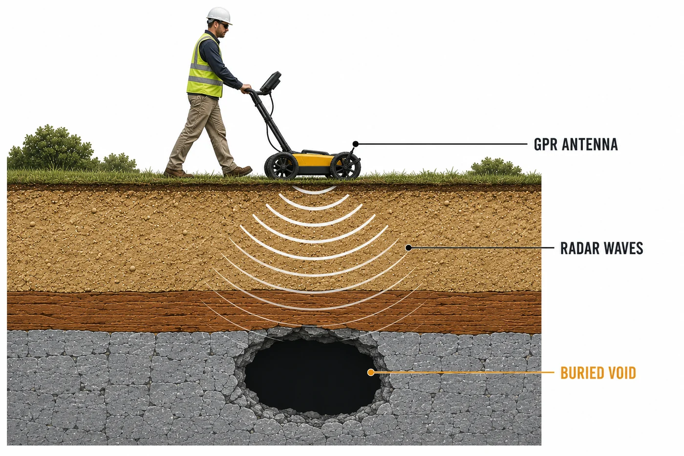
The antenna sends a short pulse of electromagnetic energy into the ground. Whenever that pulse crosses a boundary between two materials with different electrical properties — sand to limestone, soil to air in a void, concrete to steel, native sand to a plastic pipe — part of the energy reflects back. The cart records the arrival time of each reflection as it rolls, and the result is a two-dimensional slice of the ground called a radargram. A buried pipe shows as an upside-down U. A void or raveled zone shows as a disturbed, chaotic patch where the clean layering falls apart. The top of the limestone shows as a strong, irregular reflector.
Notice what's missing from that list: the words "pipe," "void," and "rock." The radar doesn't know what it hit. It knows something changed. Everything after that is interpretation, and interpretation is where the value lives and where the damage gets done. That's the entire reason our ground-penetrating radar surveys in Florida are read by an engineer who has also logged the borings that came after a few thousand radargrams, instead of by whoever was pushing the cart.
What GPR can find on a Florida site
Used for what it's good at, it earns its half-day every time. Here's the honest confidence level for each target, and what we use to confirm it when the answer has to go under a P.E. seal.
| Target | How it shows on the radargram | How reliable | What confirms it |
|---|---|---|---|
| Raveling zone above a cavity | Layering sags or breaks up in a bowl-shaped patch | Good in dry sand to about 15–20 ft; poor below the water table or in clay | SPT boring at the anomaly: low blow counts, lost drilling fluid |
| Top of the limestone | Strong, irregular reflector; pinnacles and troughs a few feet apart | Good where the rock is within antenna reach and the cover is sandy | Boring to rock, rock coring for what the rock is like |
| Non-metallic utilities (PVC, HDPE, concrete pipe) | Hyperbola (inverted U) at the pipe depth | Good to about 4–5 ft in sand; the utility locator can't see these at all | Vacuum excavation or a test pit where it matters |
| Buried tanks, vaults, drums | Large, bright, sharp-edged reflector | Very good for steel; fair for fiberglass | Phase II sampling, excavation |
| Rebar, post-tension tendons, conduit in a slab | Repeating hyperbolas on a tight grid | Excellent with a 900 MHz–2.6 GHz antenna, typically to 12–18 in. | Usually none needed — mark and cut around it |
| Voids under a slab or pavement | Strong flat reflector with a gap beneath it | Good for shallow, air-filled voids; water-filled voids are subtler | Core through the slab, probe the void |
| Pavement layer thickness | Continuous horizontal reflectors at each layer change | Very good with a calibration core every so often | A few pavement cores tie the radar depths to real inches |
| Buried debris, stumps, old foundations | Chaotic reflections, often confused with karst | Detects it well; identifies it poorly | Test pit or boring — this is the classic false sinkhole |
| Water table (sometimes) | Flat, continuous reflector in clean sand | Fair; often invisible in fine or clayey sand | Measured directly in the borehole |
Two of those rows do most of the work in this part of the state. On a suspected sinkhole, the radar tells us where the overburden is disturbed so the drill rig goes to the right spot instead of to a grid. On a job site, it finds the irrigation main and the private sewer lateral that Sunshine 811 doesn't mark, because 811 only marks the public utilities, and only the ones a conventional locator can trace.
What GPR can't find, and what it can't tell you
This is the part of the sales pitch most GPR outfits leave out. Six limits, none of them negotiable:
- Anything below its reach. In dry Florida sand, a 100–400 MHz antenna sees roughly 15 to 20 feet. That's the ceiling, not the average. Across Marion, Citrus, Hernando, and Sumter counties the limestone is often 10 to 40 feet down, so on a lot with 30 feet of cover, the cavity that matters is below the picture. A sinkhole boring goes 60 to 80 feet, or 10 feet into competent rock, for exactly this reason.
- Anything under wet clay or salty groundwater. Conductive ground soaks up the pulse. On the Hawthorn clays of eastern Marion County and Putnam County, and in the brackish water table along the Citrus and Hernando coast, useful depth can drop to 5 feet or less. The radargram doesn't go blank — it goes quiet, which is worse, because quiet looks like "clear."
- What the anomaly is. A raveled zone above a void, a buried stump, a backfilled utility trench, a chunk of construction debris, and the edge of an old septic drainfield can all produce the same disturbed patch. Radar sees the contrast. It doesn't see the cause. That's why "GPR found a sinkhole" is never a sentence we'll write.
- Anything under a strong reflector. A rebar mat at 6-inch centers, a wet clay layer, a steel plate, a metal-lined slab — the pulse bounces off the first hard boundary and very little goes through. What's below it is a guess.
- Small targets at depth. Resolution falls with depth and with lower frequency. As a rule of thumb a feature needs to be on the order of a quarter of the radar wavelength across to show at all, so a 6-inch cavity at 15 feet is invisible to the deep antenna, and the shallow antenna can't get to 15 feet.
- Exact depth without calibration. The cart measures time, not feet. Converting one to the other depends on how wet the soil is, and moisture changes with the season and with depth. Without a boring, a core, or a known utility to calibrate against, a depth off a radargram is an estimate, not a measurement.
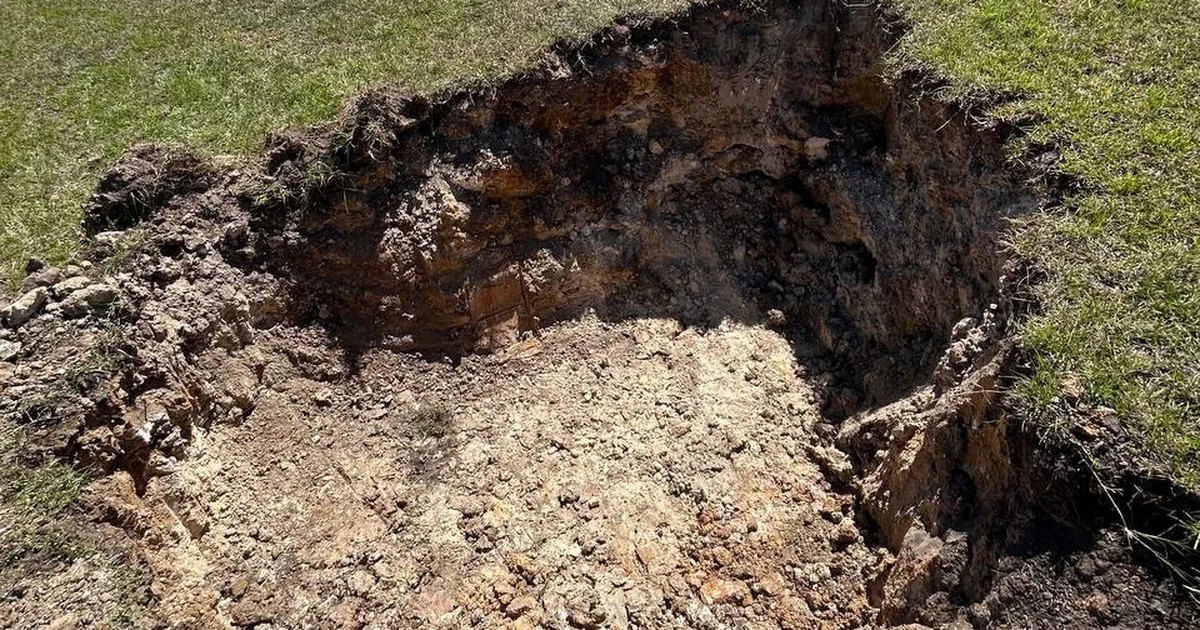
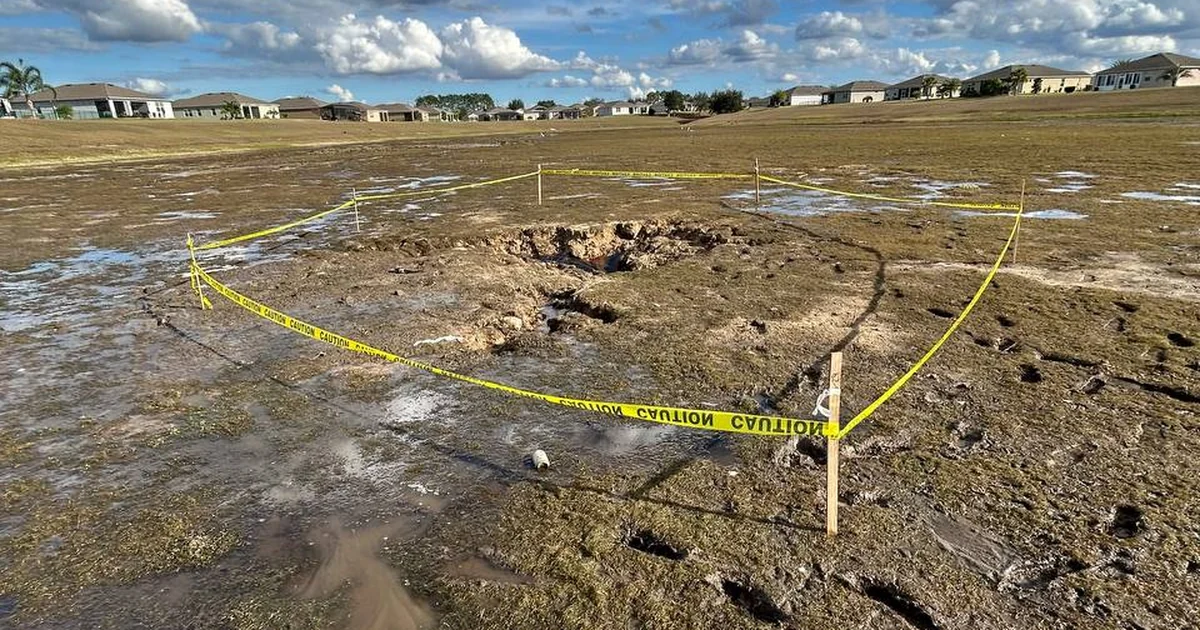
The one that costs Florida homeowners real money is the third. Every autumn we get called to look at a "sinkhole" somebody else found with a cart, and a meaningful share of them turn out to be a buried stump pile from when the subdivision was cleared. The distress is real. The cause isn't karst. The fix, the cost, and the insurance treatment are completely different, and a radar cart can't tell them apart.
Where it works and where it doesn't: Florida ground, county by county
How far the pulse travels is decided by what's in the ground, and what's in the ground changes a lot between the Ocala sand hills and the Nature Coast. The depths below are practical field ranges for low-frequency antennas, not manufacturer specs.
| Ground condition | Where you find it | Practical GPR depth | Verdict |
|---|---|---|---|
| Dry, clean sand over limestone | Ocala and western Marion sand hills, much of Sumter around The Villages, the Brooksville Ridge | 15–20 ft | The best GPR ground in the state. Karst screening works here. |
| Wet sandy flatwoods, shallow water table | Lake County lowlands, Putnam flatwoods, low ground everywhere after a wet summer | 8–12 ft | Usable. Depth shrinks; the rock is often below the picture. |
| Clay-rich cover (Hawthorn Group) | Eastern Marion, Putnam, parts of Lake County | 3–8 ft | Marginal. Fine for utilities and slabs; poor for sinkhole screening. |
| Brackish or saline groundwater near the coast | Coastal Citrus (Crystal River, Homosassa), coastal Hernando | Often 5 ft or less | Usually the wrong tool. Go straight to borings, or use resistivity. |
| Concrete slab, bridge deck, pavement | Anywhere | 12–18 in. at high frequency; 2–3 ft for pavement layers | Excellent. This is the application where GPR has no real competition. |
The four things people ask radar to do that it can't
"Just tell me if the lot is clear."
A clean radargram means no anomaly within antenna reach in the conditions on the day. It doesn't mean no cavity at 35 feet, and in wet ground it might mean the pulse never got past 5 feet. Clear is a scope, not a verdict.
"Confirm it's a sinkhole so I can file."
Confirmation is drilling: near-zero blow counts, drilling fluid disappearing into the ground, a sampler that comes up empty over a void. That's what the statute, the insurer, and the repair contractor act on. Radar decides where to drill. We explained why the drill rig, and not a cone rig, does that job in SPT borings vs. CPT for Florida projects.
"Can it see through the wet clay to 50 feet?"
No, and anybody who says theirs can hasn't run enough surveys. Conductive ground absorbs the signal. Fifty feet in Florida takes a drill rig, or electrical resistivity tomography if you need a geophysical picture that deep.
"Tell me what the pipe is made of and how big it is."
Radar gives a depth and a position for a linear target. Material, diameter, and what's inside it come from a test hole or the as-built, and the as-builts are usually wrong, which is why you called us in the first place.
Cost and time, honestly
We don't publish a flat GPR price, and we'll tell you why rather than hide it: the cost is the grid, not the acre. A tight 5-foot grid across a house footprint and the surrounding yard is a different job from widely spaced lines across a pasture. What we will commit to are the field times on this site: a quarter-acre residential lot for sinkhole screening is about a half-day; a commercial site or roadway corridor with a denser grid runs one to several days; scanning a specific slab area before cutting can be done in a couple of hours; pavement layer surveys cover thousands of linear feet per day. Field time is most of the number.
The reference point most homeowners actually need is this: a residential geotechnical report with borings, lab, engineering, and seal generally runs $1,500 to $3,500 here, and commercial explorations run $5,000 to $20,000 and up. On a sinkhole job the GPR screen is one line item inside that, and it usually pays for itself by cutting the number of borings from a blind grid to two or three targeted holes. What moves the total is covered in our guide to what a geotechnical report costs in Florida.
And the cases where we'll tell you not to buy it, because that's the whole point of an honest guide:
- A coastal lot with shallow brackish groundwater. We'd be charging you for a picture five feet deep. Borings first.
- A new build on a dry sand lot with no distress and no karst history. The permit reviewer wants boring logs and N-values, not a radargram. Put the money in the SPT borings the foundation design actually runs on; add radar only if the borings hit something odd.
- A crack you've already traced to a leaking pipe. A plumber's pressure test is the cheapest geophysics there is. Do that first.
- A slab you're about to core in one spot. A single 12-inch-by-12-inch scan is worth it. A full-slab survey to find one hole is not.
How we actually use it
GPR almost never stands alone on our jobs. On a sinkhole question the chain is radar first, then SPT borings at the anomalies, then rock coring if the rock itself is in doubt, then the lab, and every step ground-truths the one before it. That's the methodology behind every sinkhole investigation we run in Florida, and it's the reason a Citrus County homeowner gets an answer that holds up. If you're in the highest-activity part of the region, our page on sinkhole inspections in Citrus County covers what a pre-purchase look involves there, including the coastal ground where the radar has to give way to the rig early.
On a Phase II environmental site assessment, radar locates the tank and the abandoned lines before the sampling rig sets up. On a roadway, it measures layer thickness continuously so a pavement evaluation doesn't need a core every hundred feet. On a warehouse floor, it maps the voids under the slab before they become a slab failure. In every case the radar data, the boring data, and the engineering land in one report under one seal, which is the part you can't buy from a cart-only outfit no matter how good their antenna is.
Tell us what you're trying to see
Sinkhole concern, private utility locate, void under a slab, rebar before a cut, pavement thickness — describe it and an engineer will tell you whether radar is the right tool, and if it isn't, what is. Our own antennas, our own drill rigs, our own accredited lab in Ocala, and a Florida P.E. on every report, across all 67 counties. Start with the free quote form or call (352) 619-9292. What we scan, what we pair it with, and what it costs to find out is on our ground-penetrating radar service page.